
When Sailing At Sea, Who Will Guide You?
 Jul 01, 2021|
 The sea is wide and the fish leap, the sky is high and the birds fly, and love leads us to the sea. In the vast sea, what equipment and instruments will we use to guide the navigation? Follow me to take a look at today's advanced technology, which ship instruments and equipment in modern leisure voyages give you clairvoyance and smooth ears.
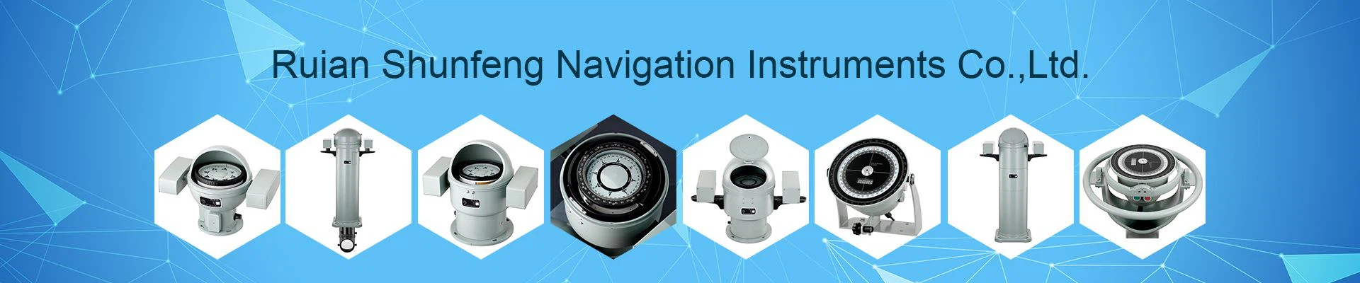
Nautical Compass/Digital Compass
When sailing at sea, identifying the direction is the most important thing. As the most popular and intuitive navigation instrument, the navigation compass is an indispensable instrument. It has the advantages of economy and practicality, mechanical parts, stability, not easy to damage, and can be designed with different appearances. The compass/compass is one of the important inventions of the working people of the Han nationality in ancient times. Its predecessor was Sinan, one of the four great inventions in ancient China. The world's earliest use of compass for navigation at sea can be traced back to the Northern Song Dynasty ships at the turn of the 11th to 12th centuries. In modern navigation, the mechanical compass can be seen in almost every ship.
The electronic equipment makes the digital compass shine, and the electronic compass has been widely used as a navigation instrument or sensor. Compared with the traditional pointer type and gimbal structure compass, low energy consumption, small size, multi-dimensional, light weight, high precision, and can be miniaturized. Its output signal can be processed for digital display, and it can also be integrated with other communication devices. It can be used for different marine systems such as autopilot, tilting and centering functions.
Maintenance Tips: After each voyage, rinse with fresh water, wipe dry with a flannel, and then close the protective cover to prevent the glass/acrylic from cracking due to sun exposure. The electronic compass is used to troubleshoot issues such as airtightness, waterproof function, circuit aging, penetration, and salt corrosion.
Mechanical: Sextant
The sextant is another important navigation and positioning instrument in navigation and aviation. The sextant combined with the chart can accurately locate the position of the ship and bring important information for navigation and navigation.
Sextant is an optical instrument used to measure the angle between two targets in the distance. It is usually used to measure the angle between the sun or other celestial bodies and the sea horizon or horizon at a certain moment in order to quickly know the latitude and longitude of the location of the ship or aircraft. The sextant has a fan-shaped shape, and its components include a small telescope, a semi-transparent and semi-reflective fixed plane mirror that is a ground plane mirror, and a movable mirror that is connected to the index, that is, the index mirror. The scale arc of the sextant is 1/6 of the circumference.
When in use, the observer holds the sextant and rotates the pointer mirror to make the celestial bodies appearing simultaneously in the field of view coincide with the sea horizon. The height angle of the celestial body can be read according to the turning angle of the index mirror. The error is about ±0.2°~±1°. With the development of technology and the application of electronic communication equipment, the sextant gradually fades out of the daily conduction function, but Sextants are still widely used in aviation and maritime commercial transportation industries.
Maintenance Tips: Wipe with alcohol, dry storage, prevent seawater/salt corrosion, spray precision instrument cleaner if necessary.
Chart/Electronic Chart
A nautical chart is a type of map that represents a map that depicts the cartographic phenomenon of ocean areas. Navigation is more accurate surveying and mapping of marine waters and coastal features, which is convenient for navigation and anchoring, and guides navigation.
The main contents of the nautical chart include: shore shape, islands, reefs, water depth, navigation aids and radio navigation stations, anchorages, typhoon shelters, dangerous areas, etc. With the nautical chart as a reference, navigation will not be easy to touch the reef and get stranded, and it is also convenient for route planning and recording. Wait. A complete and accurate chart is an indispensable reference data for navigation.
With the advancement of science and technology, we are now able to use various forms of chart display equipment terminals in addition to paper, such as chartplotters, mobile apps, tablets, computers and other hardware to obtain charts as navigation support.
Maintenance Tips: Rolled up paper and sealed in a plastic painting tube; electronic equipment, if the IP68 waterproof level is above the fresh water rinse and dry, use anhydrous industrial alcohol to wipe the ordinary waterproof. If there is a battery, it needs to be removed and stored separately. Check whether the test function is normal before going to sea and after returning home.
GPS/Beidou Global Positioning System
In modern leisure navigation, the existence of positioning systems makes maritime navigation more visual and convenient.
Global Positioning System (GPS) is a high-precision radio navigation positioning system based on artificial earth satellites. It can provide accurate geographic location, latitude and longitude, travel speed and precise time anywhere in the world and in near-Earth space. information. GPS is a new generation of satellite navigation and positioning system with all-round real-time three-dimensional navigation and positioning functions in sea, land and air.
The Beidou satellite navigation system is a global satellite navigation system independently constructed and operated by China focusing on the needs of national security and economic and social development. It is an important national time and space foundation for providing all-weather, all-time, high-precision positioning, navigation and timing services for global users. facility. In 2020, my country will complete the Beidou-3 system and begin to provide services to the world. Since the Beidou system provides services, it has been widely used in transportation, agriculture, forestry and fishery, hydrological monitoring, weather forecasting, communication timing, power dispatch, disaster relief and mitigation, and public security.
Generally speaking, the satellite navigation system will combine other electronic equipment or electronic sensors on the ship such as electronic compass/chartplotter display screen to carry out maritime navigation and navigation planning.
Maintenance Tips: Check whether the antenna is loose and the connector is waterproof every six months; check whether the GPS sensor receives the signal normally; pull out the connector to check whether there is electrolytic corrosion. If electrolytic corrosion is required, it needs to be treated in time.
AIS ship automatic identification system
The AIS ship automatic identification system is a ship identification system that must be installed in most national regulations. Mainly used for identification, communication and management. AIS (Automatic Identification System) is a ship-borne broadcast response system. Through this system, the ship can continuously send its identity and location to nearby ships and shore authorities on the VHF (note: radio wave) public wireless channel. , Course, speed and other data. According to historical evolution, AIS is a combination of VHF radio equipment called DSC (Digital Selective Calling) and a software program called SOTDMA.
AIS uses the ship's global unique coding system, that is, MMSI code as the means of identification. Ships with equipment installed are given a globally unique MMSI code from the beginning of construction to the disintegration of the ship. The use of AIS can enhance ship-to-ship data exchange and shore-based surveillance; through equipment serialization, all ships can be displayed on the electronic chart. Visualized ship name, heading, route and other information to improve maritime communication functions; AIS channel can be used to transmit shore-to-ship, ship-to-ship and ship-to-shore AIS messages, including terminal data, navigation, berth arrangements, ship agency, Current and tide information, navigation notices and other information; the ship traffic management agency can also communicate effectively with the captain and pilot through the AIS channel. In addition, combined with the personal beacon worn by the crew, it can also quickly identify the location of the crew on or near the ship falling into the water, which is convenient for rescue and rescue.
Maintenance Tips: Keep dry, check the wiring, prevent electrolytic corrosion, and turn on the power regularly to power on.
Ship Radio/Intercom (VHF)
With basic navigation equipment, ships need efficient ship-to-ship and ship-to-land base stations to communicate and exchange information quickly. At this time, it is necessary to install high-frequency/VHF radio/interphone for information interaction.
Very high frequency (VHF) refers to radio waves with a frequency band ranging from 30Mhz to 300MHz. The frequency lower than VHF radio is high frequency (HF), and the frequency higher than VHF radio is ultra high frequency (UHF).
Marine radio stations are mainly composed of antennas, transceivers, transmitters and receivers, and digital selective call terminal equipment. The radio station can use voice and digital selective calling for distress, emergency and safety calls and communications, calls and communications required for ship maneuvering, and public calls and communications.
VHF is mainly used for short-distance transmission. VHF is often affected by environmental factors such as distance and terrain. Therefore, the antenna of the radio station is generally installed at a higher position on the mast/top of the ship to obtain more transmission signals.
Maintenance Tips: Wipe the desktop computer with fresh water or alcohol; rinse the hand-held walkie-talkie with fresh water after use, and try to dry it with a hair dryer. Every time you check whether there is salt in the antenna part, wipe the battery charging port with a cotton swab and alcohol.
Marine radar/radar reflector
Marine radar is an electronic device that uses electromagnetic waves to detect targets installed on ships for navigation avoidance, ship positioning, ranging, and navigation in narrow waterways. The radar emits electromagnetic waves to irradiate the target and receive its echo to obtain the target. Information such as the distance to the electromagnetic wave launching point, the rate of change of distance (radial speed), azimuth, and height
Radar usually consists of 5 parts: antenna, transmitter, receiver, display and power supply. Since the late 1970s, the performance of radar automatic plotters has been continuously improved. The ability to capture and track targets, image and data display capabilities, anti-clutter interference capabilities, and test control functions have been greatly improved, and automatic drift compensation, Channel display and chart display and other functions.
The navigation radar will be further combined with other positioning and navigation technology, digital technology and automatic control technology to form a closed-loop fully automatic navigation and fully automatic collision avoidance system through the automatic steering system and the main engine remote control system.
Nautical radar provides necessary observation methods for navigators when visibility is poor. Its appearance is a major milestone in the development of navigation technology, and it is actually the clairvoyance of the captain.
Maintenance Tips: The radar is generally installed at a high place and in an unobstructed position. It is easier to loosen. It is necessary to check whether the mounting bracket is firm, whether the screws are loose, and regularly check whether the wiring is affected by moisture/salt and causing electrolytic corrosion.
Water depth detector
In addition to the navigation and communication equipment on the water, underwater detection equipment is also particularly important, and is an important guarantee for safe navigation and avoiding rocks.
At present, the marine water depth sounder generally uses sonar/echo sounding, but all such equipment has a common feature: they all use a set of transmitting transducers to emit sound waves underwater, so that the sound waves propagate along the coastal water medium. , It is reflected back until it hits the target, and the reflected sound wave is received by the receiving transducer. Then the computer processes the received signal, and the distance between the obstacle and the transducer can be obtained according to the time of the sound wave back and forth and the speed of the sound wave in the measured water area.
The propagation speed of sound waves in seawater varies with the temperature, salinity and water pressure of the seawater. In the marine environment, the greater these physical quantities, the greater the speed of sound. The typical value of the speed of sound in seawater at room temperature is 1500 m/s, and the speed of sound in fresh water is 1450 m/s. Therefore, the newly installed echo sounder should be calibrated and the calculated value should be corrected. When opening up new areas or navigating in shallow waters, information can be provided for navigation to ensure that the ship navigates. It can provide accurate and reliable water depth data for waterway and port surveying.
Maintenance Tips: The water depth detector of leisure boats is generally integrated with the impeller ship speed meter. It is installed in a pluggable position at the bottom of the ship. The detector can be pulled out every time it is used up, and the opening is blocked with a vacant plug; when the impeller rotates When it is not smooth, you can dry and spray Sailkote dry lubricant to reduce friction.
Ship speed detector
The (ideal) ship speed refers to the speed of the ship under no wind and no current, that is, the distance the ship travels straight to the ground per unit time in still water. Ship speed is an important performance index of ships. The speed unit usually has "knot" and "nautical mile/hour", which is a speed unit dedicated to sailing.
At present, two speeds are generally used on board leisure boats, SOG and Speed Through water. SOG (Speed Over Ground) refers to the displacement speed calculated by GPS when the ship is moving. The speed on the water is calculated using the speed calculation method of the bottom impeller to calculate the sailing speed of the ship in the water.
Maintenance Tips: Pull out each time after use, clean it regularly with a toothbrush to prevent microbes and salt crystals in the sea from increasing friction or being unable to rotate. Spray Sailkote dry lubricant if necessary.
In addition to some of the basic navigation navigation equipment above, different shipowners will add different navigation navigation aids according to the different uses of the boat, such as adding a weather forecast and receiving system; such as adding an autopilot auxiliary navigation system; such as adding a sailboat Wind speed and wind direction sensors; fishing boats increase sonar, fish detection; commercial boats increase satellite communication signals/telephones, fishing boats increase single sideband (SSB: SingleSide Band, refers to single sideband, using half of the radio wave to receive. For example, use the above With (USB) or lower sideband (LSB), the remaining half of the waveform is symmetrical to that half, so it can be complemented by a receiver. The upper sideband and lower sideband communication are collectively called single sideband
Thanks to the advancement of science and technology and the rapid change of information, at present, most of the communication equipment and instruments can be monitored and controlled through one or several integrated screens, such as machine monitoring, temperature, humidity, lighting system, and audio-visual entertainment on board. The system and so on have been highly integrated into one, so that all information can be processed on one screen.
Sigh, technology makes us safer, more comfortable and convenient to ride in the sea!